11:30 am: Started paddling 5:00 pm: Found campsite Todayĺs distance: 13.1 mi. Trip Total: 264.5 mi. GPS Readings (UTM) Lunch: 12V 469352 6517988 Camp: 12V 473577 6516428 |
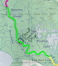 |
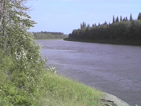
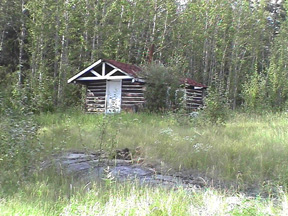
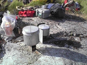
| We slept in until 9:30. I woke earlier, but with Paul not feeling well, I decided not to wake them. We had planned to camp that night where the winter road crossed the river. We guessed it was about a 12-mile paddle; that would leave 20 miles for tomorrow. We were going to stop for lunch at a rangerĺs cabin, but when we had not found it by three and we ôsuspectedö that we had passed it. However, I was getting very frustrated. We stopped and had lunch and took a GPS reading. We had indeed passed it and I felt much better. We came to a trapperĺs cabin a couple of kilometers before the winter road and decided to camp there. There were large rocks at the site that again indicated that we are nearing the Canadian Shield. Paul cooked supper and went to bed after eating. Chris and I did the dishes and Chris fished awhile. It was neat navigating from the map with Ft. Chipewyan on it. Both Chris and I are looking forward to canoeing into Ft. Chip tomorrow. It should be a special part of the trip. |
|
 |
 |
 |
 |
Journal Summary, July 8-13, July 14, July 15, July 16, July 17, July 18, July 19, July 20, July 21, July 22, July 23, July 24, July 25, July 26, July 27-28, July 29, July 30, July 31, August 1, August 2-3
Intro, Maps, History, Equipment, Personal Equipment, Menus
Exit Peace River Canoe Trip
Last updated: April 16, 2004