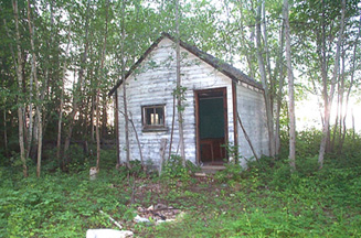
9:00 am: started paddling 5:30 pm: arrived at campsite at Vermilion Landing Today’s distance: 32.9 mi. Trip Total: 47.2 mi. GPS Readings (UTM) Lunch: 11V 598155 6469006 Camp: 11V 619957 6470675 |
 |
| The weather was good and we had a good day’s paddling. Covered about the same distances in the morning and afternoon. Had lunch near the Wabasca River. After arriving at our campsite, we walked to the end of the rapids, about 1.5 to 2 miles. The walk along an old ‘road’ used to transport gear and boats was very buggy and we put on our bug jackets. We decided that we could do a combination of lining and paddling to get through the rapids and thus avoid the long (4 mi. triple-pass portage). We got back to camp about 8:00 and decided to use one of the lunches for dinner as we were too tired to cook. |
|
 |
 |
Journal Summary, July 8-13, July 14, July 15, July 16, July 17, July 18, July 19, July 20, July 21, July 22, July 23,
July 24, July 25, July 26, July 27-28, July 29, July 30, July 31, August 1, August 2-3
Intro, Maps, History, Equipment, Personal Equipment, Menus
Exit Peace River Canoe Trip