8:00 breakfast at motel 11:00 am started paddling 1:30 lunch 4:30 - 5:00 pm found campsite. Todayĺs distance: 14.3 mi. Trip total: 14.3 mi. GPS Readings (UTM) Start: 11V 558930 6473717 Lunch: 11V 565678 6480837 Camp: 11V 576228 6473763 |
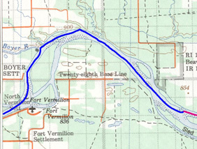 |
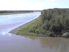
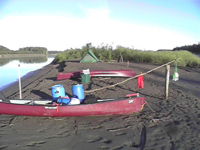
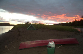
| After breakfast at the motel, we took the gear to the launch point and carried the canoes and food to the river. While Paul and I rigged the canoes, Chris returned to the motel for the remaining items (some of which were not needed on the water). Chris and Paul paddled the tandem canoe and I paddled the solo. We paddled from the dock to the confluence of the Boyer and Peace Rivers. It was here that Charles Boyer established a NWC post in the 1780s. We climbed a high bank on the north side of the Boyer River but all we saw was cultivated fields to the north. We then walked into the woods on the west bank of the Peace up stream from the Boyer. It was dense underbrush and we didnĺt see any signs of the excavated site. I learned later that the side was a short distance up river from where we looked. We spent about 45 minutes here. It started to rain just as we packed up after eating lunch and rained most of the afternoon. We got our first lesson about camping on the Peace River when looking for a campsite. There looked to be flat areas on the high ground along the river where the spring ice breakup had knocked down the trees. On stopping, we found they were in fact very muddy, rough and full of down wood. This proved true for the entire trip. We ended up camping on an island point that was a mud flat. The mud along the Peace is very sticky. When we setup camp and were cooking, our feet would slowly sink into it. Dinner was Mac and Cheese with Cheese Cake for dessert; we were finished cleaning up by 7:30. There was still a lot of daylight left. It was still light at midnight and was light at four this morning. We were tired at the end of an enjoyable day. |
|
 |
 |
 |
 |
 |
 |
Journal Summary, July 8-13, July 14, July 15, July 16, July 17, July 18, July 19, July 20, July 21, July 22, July 23,
July 24, July 25, July 26, July 27-28, July 29, July 30, July 31, August 1, August 2-3
Intro, Maps, History, Equipment, Personal Equipment, Menus
Exit Peace River Canoe Trip
Last updated: April 13, 2004