9:15 am: Started paddling 6:15 pm: Found campsite Todayĺs distance: 34.1 mi. Trip Total: 220.2 mi. GPS Readings (UTM) Lunch: 12V 439593 6551008 Camp: 12V 438903 6540308 |
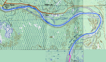 |
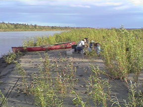
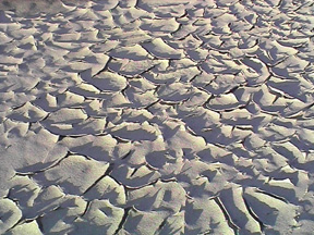
| Charlie had a pot of coffee brewing when we got up and after the coffee drinkers got their morning fix, Charlie took our gear down to the river on his truck, we loaded our canoes and said our good-byes. We stopped about an half-hour later for breakfast using left-overs. We had lunch about two and shortly after, we encountered wind. We were able to avoid most of the effects except for one small stretch where the river curled back and headed west into the wind. The wind started blowing hard and Paul and I were in the middle of the river. White caps and large swells formed and Chris, who was near the north shore said he saw light under our canoe a couple of times. We worked ourselves to the south bank and pulled ashore. The wind started to die down and we were able to paddle around dead-falls to a point on the river bank where the river turned south. The combination of the wind dying down and the change in river direction allowed us to safely cross the river and rejoin Chris. The rest of the afternoon went well. We setup camp and then took it easy. Paul slept and Chris and I walked around the large sand/mud flat we were camped on. We cook supper about eight and then enjoyed the rest of the evening. A motorboat passed our campsite, the third boat/canoe that we saw on the trip. It has been a fantastic trip. The mixture of hard and easy days has worked well and we have met some great people. |
|
 |
 |
Journal Summary, July 8-13, July 14, July 15, July 16, July 17, July 18, July 19, July 20, July 21, July 22, July 23, July 24, July 25, July 26, July 27-28, July 29, July 30, July 31, August 1, August 2-3
Intro, Maps, History, Equipment, Personal Equipment, Menus
Exit Peace River Canoe Trip
Last updated: April 13, 2004