10:00 am: Started paddling Todayĺs distance: 3.7 mi. Trip total: 50.9 mi. GPS Readings (UTM) Lunch: 11V 622432 6470488 Camp: 11V 624942 6471016 |
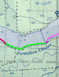 |
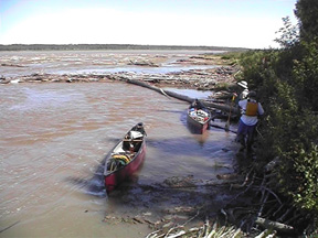
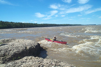
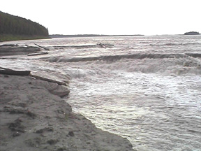
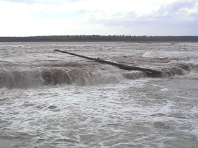
| We slept to 9:00 this morning. When we got up I was not feeling well. After breakfast, we paddled to the head of the rapids. Paul and Chris did a combination of lining and paddling as planned at the rapids; I filmed the activities. We ate lunch at the base of the rapids. I slept during lunch and did not eat anything. After lunch, we paddled down to the falls, lining the last few hundred yards because the current was too swift to safely canoe (the potential of being caught in the current and pulled out from shore and over the falls was too great). At the head of the falls I again slept while Paul and Chris scouted the area. They came back and we setup the dining fly for shade and I slept some more. By the end of the afternoon I was feeling better and was able to help portage the canoes and food. I cooked dinner including brownies. We set up the tent at the head of the portage (about 50 yards long) and the kitchen at the end. The long days throw our timing off. The GPS indicates that sun set is 10:33 and sunrise is 4:57. It never really gets dark, just dusk. |
|
 |
 |
 |
 |
Journal Summary, July 8-13, July 14, July 15, July 16, July 17, July 18, July 19, July 20, July 21, July 22, July 23,
July 24, July 25, July 26, July 27-28, July 29, July 30, July 31, August 1, August 2-3
Intro, Maps, History, Equipment, Personal Equipment, Menus
Exit Peace River Canoe Trip