PAGE INDEX
Route
Preparation
Schedule
References
The Crew
Rendevouz
DESTINATIONS
Missinipi
Stanley Mission
Potter Rapids
Grand Rapids
Frog Portage
Grassy Narrows
Pelican Narrows
Dog Rapids
Maligne Lake Settlement
Snake Rapids
Amisk Lake
North Channel
Denare Beach
Guest Book
Return to main |
THE PLAN
Canoe to the Village of Pelican Narrows (23 km)
Have an opportunity to "check with your stock brokers" and contact your families
Can up-grade our supplies if necessary
3 or 4 portages. Maximum total distance is 210 m (230 yd)
|
| MAPS |
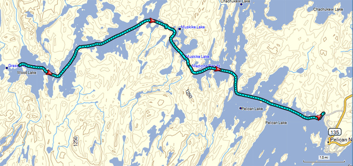
Grassy Narrows to Pelican Narrows
Downloaded: Maps 6-A, 6-B
1:250,000 Series: 63M Pelican Narrows
1:50,000 Series: 63M/3 Sandy Narrows, 63M/2 Pelican Narrows |
NOTES
from
Marchildon
&
Robinson
unless otherwise noted |
Pot Hole (Three Together) Rapids
- These rapids are un-named in early literature
- Name comes for Cree name for rapids which means "three together"
- J. B. Tyrrell reported they were called the Pot Hole Portages
- All three rapids must be portaged
First Pot Hole Portage: 55 m / 60 yd
- At outflow of Woods Lake. Here wood/rock weirs restrict the flow and raise the level of Woods Lake
- Portage on island in middle of rapids about 30 m (100 ft) right of the northeast (river left) channel
- Has boat pullover rack to drag canoes (if they are sturdy)
- Peter Fiedler and Philip Turnor camped on this island on June 22, 1792.
- From Turnor's journal
- "22nd Friday at 3 3/4 AM got underway went about 1 mile and met 4 Canoes of Chepawyans went 2 mile more and found on other Canoe of Chepawyans from whom we got the flesh of a small Beaver went 3 miles and met a Mr Mackie [William McKay] and three Canadians going to build a house at the Deers Lake that lays on the North of the Churchill river through which lake it is said there is a near way to the Athapescow Lake, they had 7 or 8 Canoes of Che-pa-wy-ans with them from whom we got a little Moose flesh we then went about 9 miles and was obliged to put on shore the wind being to strong we lay bay from 10 1/4 AM until 2 1/2 PM at which time the Wind was not quite so violent we then went to the next carring place [First Pot Hole Portage] carried over and put up at 8 1/2 PM Wind NW by W a heavy gale with flying clouds and a few showers of rain in the afternoon sailed the forepart of the day
- "23rd Saturday at 3 3/4 AM got underway and carried over the tow next carrying places and handed down the one we carried part at in going up [Medicine Rapids] then put on shore to pitch our Canoes and was stopped by the rain about 2 hours..."
Second Pot Hole Portage: 20 m / 22 yd
- About 150 m (165 yd) downstream from #1
- Crosses northeastern tip of island between two rapid channels
- Take-out is in quite water; put-in is in fairly fast water
- Has pullover rack
Third Pot Hole Portage 50 m / 55 yd
- About 400 m (1/4 mi) from #2
- Pullover rack located about 140 m (150 yd0 northeast of outflow channel. Note: There is a broken-down abandoned rack closer to the channel.
Medicine Rapids Rock Paintings
- Site #1. Location: 63M 241202
- Most elaborate in group. Six figures, with the main figure about 85 cm (34 in) high
- East side of channel out of Muskike Lake. Paintings on 2-m-high (6-ft) negatively inclined rock facing northwest. Rock is at base of a 25 m (80 ft) high round-topped rock hill.
- About 1 m (3 ft) above water line when seen in 1986.
- Site #2. Location 63M 241199
- River right about 100 m (110 yd) upstream of rapids.
- Two figures near black tar initials
- Site #3. Location: 63M 242199
- River left about 30 m (100 ft) upstream of rapids
- Two separate displays on a 15-m-high (50 ft) gneiss outcrop
- First display has 5 figures on a nearly vertical face about 3 m (10 ft) from the bend in the shoreline. In 1986, about 1 m (3 ft) above the water.
- 6 m (20 ft) downstream after the bend. About 50 cm (20 in) higher than first. Geometrical design.
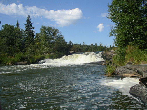
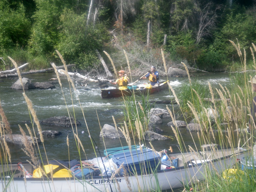
Medicine Rapids
- Fast-flowing, 85 m (93 yd)long, 5 m (16ft) wide. Navigable channel is 2 m (6 ft) wide, straight and has line "mainly" free of rocks.
- Can be run, poled or lined after scouting if you have advanced skills
- Portage is 85 m (93 yd) on river left. Pullover rack begins immediately above the rapids. Has walking trail along east side of rack.
- Some history
- Philip Turnor stated that voyageurs normally treated rapids as a decharge going upstream
- George Simpson referred to the rapids as "Discharge des trois Petit Portage"
- Sir John Richardson referred to them as "the Pelican lightening-place" (Demi-charge de chetauque)
To Pelican Narrows
- About 9 km (5 1/2 mi) from Medicine Rapids.
- Need to pay attention to navigation to avoid missing the channel south to Pelican Lake and instead going north on Chachukew Lake
- Island obscures Pelican Narrows; will not see community until you round southern tip of island
- Two landing places: 1) across or slightly north of southern tip of island and 2) public dock around southwest corner of the community peninsula (south shore)
- Interesting history
- On Sept. 20, 1790, Philip Turnor's (HBC) Indian guide quite while camped at Pelican Narrows near where the Anglican Church stands today. The only way he could proceed north was when Patrick Small (NWC) arrived and agreed to let them follow him to his post in Il-a-la-Crosse.
- From Malcom Ross' journal: "I gave a treat of brandy to the Indian pilot last night, also a Coat & Blanket for his wife; he promised faithfully to stand by us, but this day when he was to embark his wife would not go, after all his promises we embarked at 1 P.M. after applying to Mr. Small for his assistance in showing us the Road, which we was obliged to do at else go back again, which I had very had will to do."
- From Peter Fiedler's journal: "The Pilot that was engaged to conduct us from Cumberland to the Isle a la Crosse deserted us 5 days journey from Cumberland House, in the Pelican lake, and the rest of the way we accompanied the Canadian canoes by the permission of Mr. Small on condition that we should not trade any skins from the Indians this winter tat is past."
|
THE TRIP |
 |
| Today we did the Pot Hole portages...nothing spectacular about them...but it is amazing that the small weir at the first rapid controls the height of the water we have been canoeing since leaving Frog Portage. We were on the water by eight and arrived at Pelican Narrows at two; we had paddled 13.6 miles. There were questions about where we would camp and we ended up camping on the roads at the water access. Not the best or most scenic campsite, but it worked. After setting up camp, some went into Pelican Narrows while others stayed in camp. |
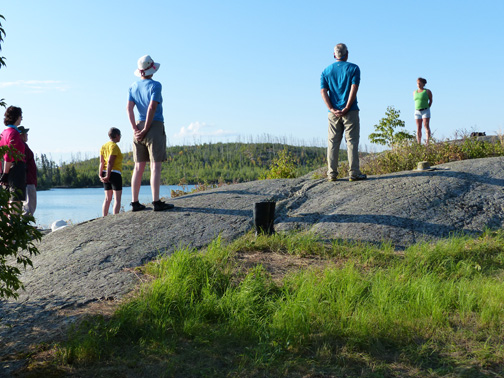
Anyone for yoga before hitting the water? |
Pot-Hole Rapids and portages |
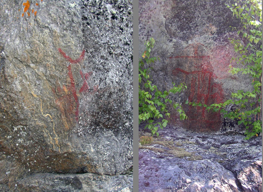
Medicine Rapids Rock Paintings |
Jackie and Karl |
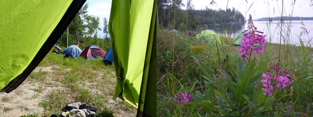
Amazing what some flowers will do for a campsite |
|