PAGE INDEX
Route
Preparation
Schedule
References
The Crew
Rendevouz
DESTINATIONS
Missinipi
Stanley Mission
Potter Rapids
Grand Rapids
Frog Portage
Grassy Narrows
Pelican Narrows
Dog Rapids
Maligne Lake Settlement
Snake Rapids
Amisk Lake
North Channel
Denare Beach
Guest Book
Return to main |
THE PLAN
Sunday morning breakfast (supplied)
Vehicles stored
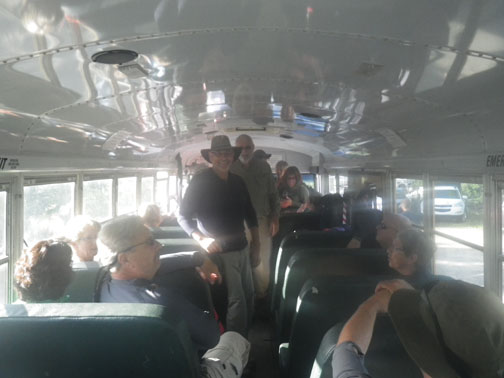
Canoes and equipment loaded
Group transported to Missinipi camp ground (Otter Lake)
Set up our camp
Those who wish on their own can play in Otter Rapids
|
OTTER RAPIDS
from
Marchildon
&
Robinson |
History
Phillip Turnor was traveling downstream on June 19, 1792. He reported in his journal that they lined the upper portion of the rapids and then shot the bottom part. Exactly 28 years later, John Franklin was traveling upstream. They attempted to track the canoes up the rapids. The first canoe made it, but the second got caught in the current and was swept downstream. The first canoe then successfully ran the rapids in an attempt to rescure the canoe and the two expedition members in it. They were able to recover the canoe and one of the crew, but Louis Saint Jean drowned. They place a cross at the rapids in his memory.
The Rapids
The Class 3 rapids is about 600 m long. It is relatively straight run, but it is famous for it high waves at the start; they can be as much as 2 m (6 ft.) high. There is not much danger or rocks, but there is a good chance you will take on water, possibly swamping. The rapids can be scouted from the bridge. There is a ledge upstream river right and a major boil downstream river right. It is best to start down the wide central tongue and then ferry left. Once past the bridge, you should be "home free".
The Portage
The portage is river left. The portion west of Highway 102 is wide but steep and rocky in places. The portion east of Highway 102 is not as steep. Length: 560 m (610 yds.) |
THE TRIP |
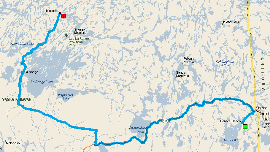 |
Two-hundred-sixty miles and over five hours on the bus brought us from Rock View in Denare Beach to our campsite at the base of Otter Rapids.
It was up early, the rule for the trip, breakfast with the entire crew at Rocky View and then load the canoes onto the trailer, pack the gear in the bus and get on the road about nine.
There was a brief stop at Pawistik Lodge on the Hanson Lake Road to stretch our legs...and get some BIG cinni-buns...then back on the road with a brief stop in La Ronge before arriving at our campsite. The rest of the day was spent getting things ready for tomorrow, exploring the area, checking out Otter Rapids and watching Ellie, Roger, Wayne and Merle run them and of course, finding the geocache (GC3PMV1) located at the rapids. |
Loading up at Rocky View |
The canoes arrived safely at our Missinipi campsite |
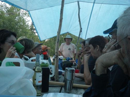
The Bourgeois holds court to give us "the word |
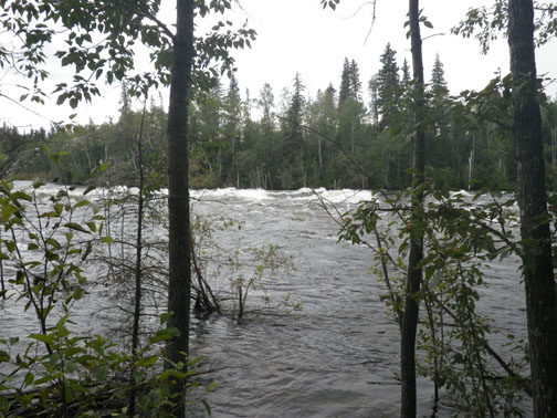
Otter Rapids below the bridge |
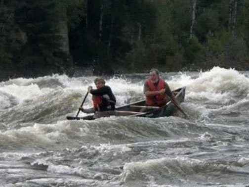
Ellie and Roger running Otter Rapids |
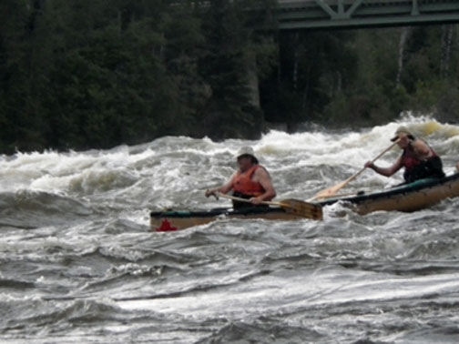
Wayne and Merle coming through |
|