PAGE INDEX
Route
Preparation
Schedule
References
The Crew
Rendevouz
DESTINATIONS
Missinipi
Stanley Mission
Potter Rapids
Grand Rapids
Frog Portage
Grassy Narrows
Pelican Narrows
Dog Rapids
Maligne Lake Settlement
Snake Rapids
Amisk Lake
North Channel
Denare Beach
Guest Book

Return to main |
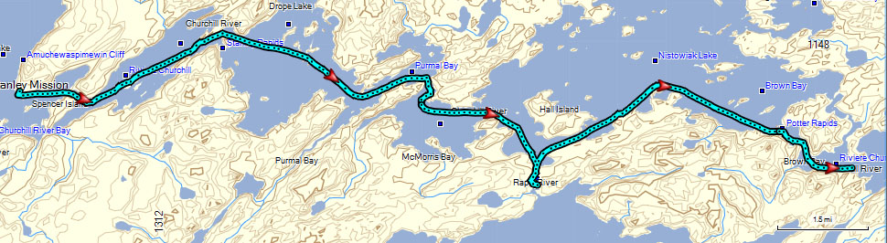
POTTER RAPIDS
THE PLANPaddle to Potter Rapids (20 km)
Stop at Nistowiak Falls, one of the highest in Saskatchewan
Two (or one) portages; maximum distance 190 m/209 yds.
|
| MAPS |
Stanley Mission to Potter Falls
Downloaded: Maps 2-A, 2-B
1:250,000 Series: 73P Lac la Ronge
1:50,000 Series: 73P/7 Stanley Mission, 73P/8 Nistowiak Lake |
NOTES
from
Marchildon
&
Robinson
unless otherwise noted |
Rock Paintings
- On point west of channel to Stanley Rapids (73P 324424)
- Southeast side (river left) of peninsula. About 100 m (110 yds) from tip there is a jumble of rocks. Located just past the rocks on two large square rocks faces 1-2 m (3-6 ft.) above the water.
Stanley Rapids
- Located 500 m (1/3 mi.) from rock paintings. Two options; north channel is safer and the recommended route.
- Little Stanley Rapids (north channel)
- Can be run at normal water levels. Must scout.
- 50 m (55 yds) of strong Class 2 rapids followed by a similar length section of swift but easy rapids.
- Little Stanley Rapids is the route used by voyageurs; it was a decharge (run with reduced load)
- From Peter Fidler journal for trip with Philip Turnor on June 19, 1792: "Carry on North side 90 yards part. The other part is taken up in the Canoe by handing along the shore. We now shot it down & put up here & set our net."
- Little Stanley Portage (90 m/99 yds)
- Take-out is located about 60 m (65 yds) upstream of rapids, river left at a break in the shore willows.
- Good landing at downstream end
- Little Stanley Pullover w/rollers (40 m/45 yds)
- Take-out river right. Advance cautiously around point and paddle 50 m toward head of rapids.
- Haul boat over rollers
- Put-in is before the swift section of the rapids.
- Big Stanley Rapids
- Major Class 3 rapids
- Can be run in slick on river right, but care must be taken to avoid slipping into dangerous hole.
Drope Lake
- A blank sand beach is located on the north shore of the most easterly large island (73P 349429).
- Old uranium mind on south end (73P 339400)
- Uranium was discovered here in 1949, but the mine did not operate long after the mid 50's.
- Sigurd Olson noted in 1955: "As we portaged Stanley Rapids and entered Drope Lake we could see a smudge of smoke, some buildings, and another uranium mine far to the southwest. The sun glittered on the shiny new roofs, and I should not help but think again of what Hemingway said about Africa, 'A continent ages quickly once we come.'"
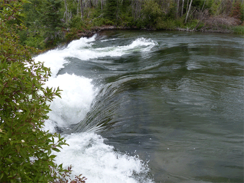
Frog Narrows from Parks Saskatchewan: Narrows connects Drope and Nistowaiak Lake and the current can vary from moderate to fast. Special care should be taken because of eddies and boils. When in doubt, line canoes.
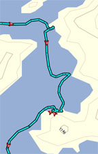
Nistowiak Falls
- Rapid River flows into Churchill here; falls and rapids are 16 m (50 ft) drop.
- View from half-way up portage trail at Jim's Camp.
- Peter Fielder showed a post located at this site in a sketch made June 20, 1792.
- David Thompson noted "River aux Rapid where we found Roy by himself" on August 27, 1798.
Potter Rapids
- Three channels; all with a 2 m (6 ft) drop
- Portage (100 m / 110 yds) next to Angler Rapids Wilderness Camp; 2-m-wide (6-8 ft) boardwalk.
|
THE TRIP |
 |
Capsized |
Today we saw pictographs and Nistowiak Falls (a 1-mile roundtrip hike) and experienced teamwork at its best, lining canoes around Little Stanley Rapids and carving out a campsite that would fit 11 tents, the first of many nights we had to do this, and we paddled 15.7 miles...all of this in about 9 hours.
A Special Group. All trips have moments/events that define them. We had signs of that yesterday on the portages, but today we experienced just how special this crew was. Noon was approaching and we were looking for a place to eat lunch. A nice location was spotted and the lead canoes headed for it. They soon encountered fast water with very strong eddy lines that made it potentially unsafe for 10 canoes to land. The rest of the canoes were told to take a path further out from shore and we would look for another lunch spot. Unfortunately, one of the canoes got caught by one of the eddy lines and capsized. Immediately, each canoe assessed the situation and based on their location and skills, took a course of action. Some helped the capsized canoe and the paddler still with the canoe to shore where the canoe could be emptied. Another helped the paddler separated from the canoe get to shore. Others looked for a safe place for the group to land, gathered wood and started a fire. A pot of water was heated for hot drinks and a tarp was retrieved to offer privacy so the wet paddlers could change clothes. When the wet paddlers got to the area, they immediately were able to get into warm, dry clothes and have hot drinks to warm themselves. We then took time for lunch. Indeed this was a special group of paddlers. |
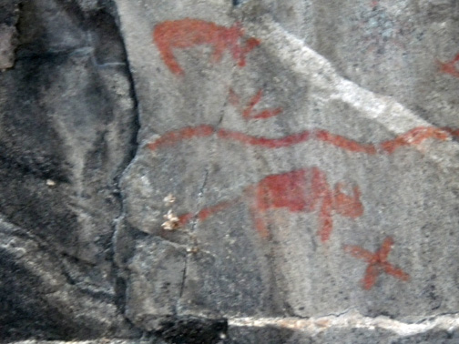
Rock paintings west of Little Stanley Rapids |
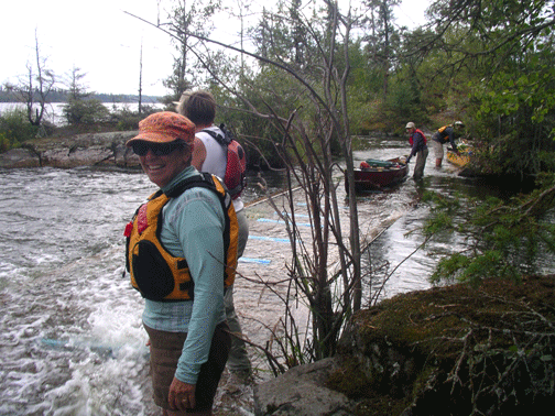
Lining around Little Stanley Rapids; Delores digging in below rapids; Ellie and Al coming to shore |
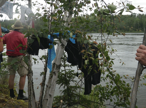
Drying clothes and having lunch after THE DUMP |
Nistowiak Falls |
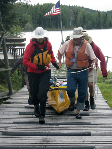
Potter Rapids portage. This is a portage? (It can be more work than it looks.) |
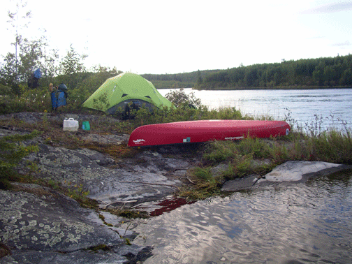
First of several campsites cut from the bush |
Aug. 5 (previous day), Aug. 7 (next day)
|