PAGE INDEX
Route
Preparation
Schedule
References
The Crew
Rendevouz
DESTINATIONS
Missinipi
Stanley Mission
Potter Rapids
Grand Rapids
Frog Portage
Grassy Narrows
Pelican Narrows
Dog Rapids
Maligne Lake Settlement
Snake Rapids
Amisk Lake
North Channel
Denare Beach
Guest Book
Return to main |
THE PLAN
Paddle to Stanley Mission (30 km)
See the Holy Trinity Anglican Church
Two portages totaling 370 m (405 yds)
|
| MAPS: |
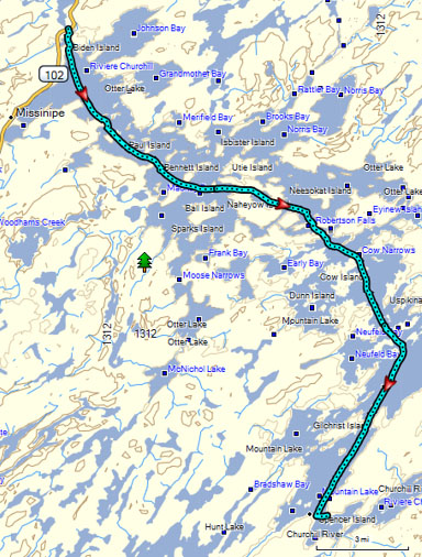
Otter Rapids to Stanley Mission
Downloaded: Maps 1-A, 1-B, 1-C, 1-D
1:250,000 Series: 73P Lac la Ronge
1:50,000 Series: 73P/10 Otter Lake, 73P/9 Guncoat Bay, 73P/8 Mistowiak Lake |
NOTES
from
Marchildon
&
Robinson
unless otherwise noted |
There are a couple of options to this route. Based on the distance (~30 km) and the distances published in Canoeing the Churchill, it appears we will not be doing any of the optional loops. The following information is based on that assumption.
Otter Lake
- Has many odd-shaped peninsulas and over 150 islands. Makes good and constant map reading a must.
- 16 km (10 mi) from Otter Rapids to Stoney Mountain Portage.
Stoney Mountain Portage (85 m / 95 yd)
- By-passes 3-m-high (10 ft) Robertson Falls
- East of falls ~ 40 m. Can see portage going up bedrock into a stand of pines
- Steep at both ends; if wet, can be very slippery on the east end
- From Saskatchewan Parks, Canoe Trip #5
- Portage starts on the west shore of Eyinew Island about 45 meters (49 yards) above the head of the fall (Grid location 277563, Map 73, P/10).
- The portage can be seen from the water and appears as a break in the spruce and birch of the shoreline.
Mountain Portage (285 m / 310 yd)
- Located about 500 m (1/3 mi) from Stoney Mountain Portage
- Dirt landing can be slippery when wet; portage good
- From Saskatchewan Parks, Canoe Trip #5
- Approximately 275 m (301 yd) long and in good condition. This portage by-passes a 6 m (20
ft) fall.
- Portage starts at a small cove along the southeast shore about 45 m (49 yd) west of a group of outfitter's camp buildings.
- Portage shows as a break in the trees immediately east of two small islands (Grid location 280558, Map 73, P/10).
piyak onikahp; Alternate portage (Cree name) to Stony Mountain/Mountain Portages (325 m / 355 yd)
- Located about 1 km (2/3 mi) east of Robertson Falls
- Strong currents at foot of Twin Falls make this portage impractical for canoeists.
Mountain Lake
- 17 km (11 mi) to Stanley Mission
- Pictographs
- Faint rock paintings at Cow Narrows (73P 297545). About 6 ft above water on outcropping that slops back. Graffiti around paintings.
- Mountain Lake Peninsula; Site #1. 350 m (380 yds) southwest from tip (73P 303475). On pie-shaped rock face about 3m (10 ft) above water
- Mountain Lake Peninsula; Site #2. 45 m (50 yds) south of Site #1. Noticeable 1-m (3-ft) deep recess lined with rock tripe on cliff face. Two small paintings to the viewer's left.
- Four Portages Bay. Cliff 12 m (40 ft) high on west shore (73P 266444). About 2 m (6 ft) above water.
Holy Trinity Church: Built by Robert Hunt or the Anglican Church between 1854-1860. Oldest building in Saskatchewan.
HBC moved their Rapid River trading post to Stanley Mission in 1853. |
THE TRIP |
 |
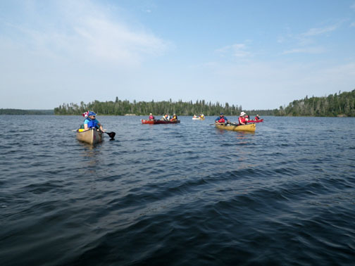
No easing into the paddling...this was our longest day of the trip. We were on the water a little before eight and 10.5 miles/16.8 km and a little less than four hours later, we were at Stoney Portage, our first on of the trip. It was then only 0.4 miles/0.6 km to Mountain portage. After the portage, we finished our day with a 11.3 mile/18.1 km paddle to Stanley Mission, arriving there about quarter to six. That totals 22.2 miles/35.5 km and two portages in 10 hours...mighty fine!
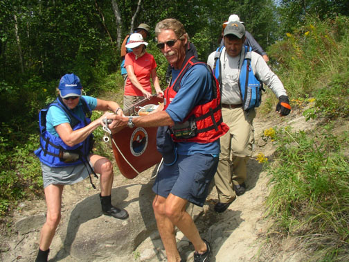
The portages went like clockwork...would never guess that twenty people who had never paddled together as a group could work as one from the start. Amazing! And even more amazing, it continued through the entire trip! Stoney Portage was a more typical portage, but you could still carry partially loaded canoes. Mountain Portage went through the grounds of Beyond La Ronge Lodge and had a ramp/stairs at the steep put-in. After portaging, we ate lunch at Mountain Portage.
We camped on the grounds of Stanley Mission...what a great way to start our trip over this historic voyageur canoe route. Before arriving at the campground, we stopped at the town of Stanley Mission just across the river. We tried to ease Denny's withdrawal pains with an ice cream run but he was nowhere to be found when the ice cream arrived. Least we felt tooooo good about what we had canoed, we met a youth group just returning from a multi-day trip; the counselors had their less than 1-year-old baby with them on the trip! Yes, they did have a life jacket for her.
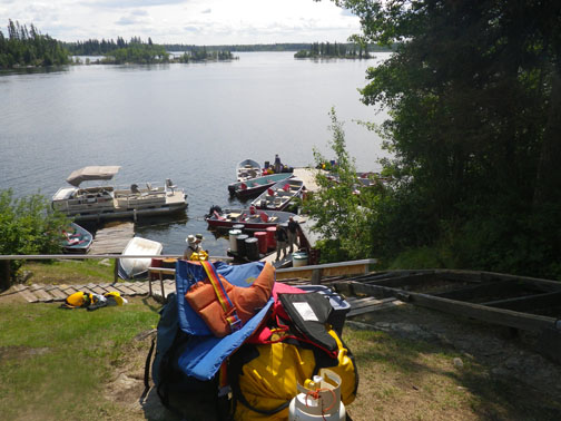
The campground was very nice...lots of room, pavilion to cook and eat, places to dry tents from last night's dew. Sid Robinson, author of Canoeing the Churchill, and his wife paddled over to our camp and talked to us about the river and answered many questions.
We visited the Anglican Church built in the 1850's and the oldest building in Saskatchewan. It was beautiful. The main entrance faced the river and there was a walk way from the water to the church for those attending; most if not all would arrive by water. The church cemetery was equally as beautiful. Its fenced in graves and painted a multitude of colors showed the love and care given to Stanley Mission. |
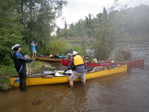
Getting on the water! |
Hey, which way to we go? |
 |
 |
| The ends of portages aren't all alike: Stoney Mountain on the left, Mountain on the right. |
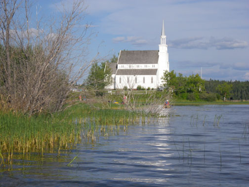
Holy Trinity Anglican Church |
So, what do you think is the primary mode of transportation to church? |
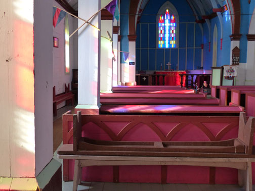
Inside Holy Trinity Anglican Church |
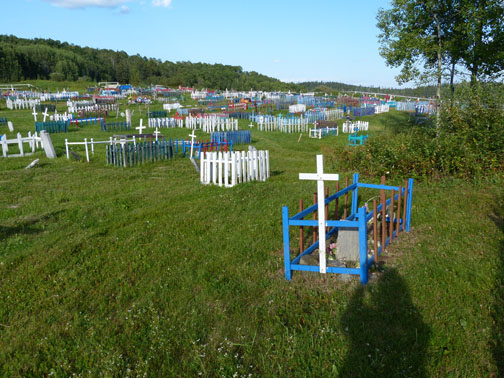
Church cemetery |
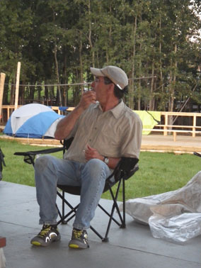
Sid Robinson at camp |
|