PAGE INDEX
Route
Preparation
Schedule
References
The Crew
Rendevouz
DESTINATIONS
Missinipi
Stanley Mission
Potter Rapids
Grand Rapids
Frog Portage
Grassy Narrows
Pelican Narrows
Dog Rapids
Maligne Lake Settlement
Snake Rapids
Amisk Lake
North Channel
Denare Beach
Guest Book
Return to main |
THE PLAN
Will be on the Sturgeon Weir River
Paddle 30 km
Camp at Grassy Narrows
One portage: 330 m / 360 yds
|
| MAPS |
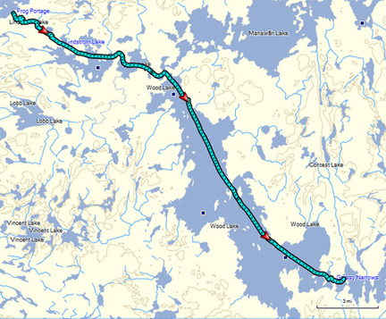
Frog Portage/Sturgeon Weir to Grassy Narrows
Downloaded: Maps 5-A, 5-B, 5-C
1:250,000 Series: 63M Pelican Narrows
1:50,000 Series: 63M/6 Manawan Lake, 63M/3 Sandy Narrows |
NOTES
from
Marchildon
&
Robinson
unless otherwise noted |
Frog Portage: 330 m / 360 yds
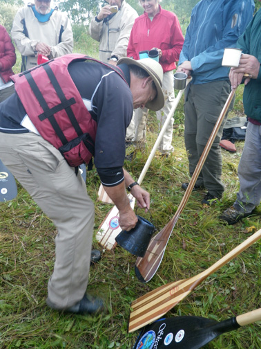
- Historical marker/cairn for portage located at the start
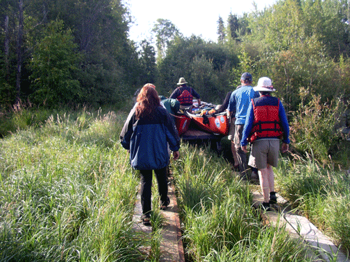
- Can use portage car (may be difficult to control), drag canoes over railway's ties, or carry on traditional portage along east side of the railway.
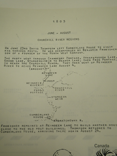
- Height of Land. Water flowing north through the Churchill River flows to Hudson Bay. Water that flows down stream goes to the Saskatchewan River.
Sturgeon Weir River
- Got its name from the sturgeon weirs placed by the Cree in the southern part of the river
- Peter Fiedler, June 21, 1792 on passage immediately southeast of Frog Portage. "went thru this kind of swampy creek 3 miles between NNE & SSW making ESE 1 1/2 & came to another portage on S side 90 yards over the creek being choked up with large stones here--that in some years when water is low Canoe also must be carried--this swamp creek from 5 to 500 yards wide as below [map]--went below the carrying place thru the same kind of creek 1 1/4 mile making ESE 3/4 & entered a small lake & put up" Because of the above weir, these rocks are covered with water.
- Alexander MacKenzie description of the route from Wood Lake to Frog Portage. "The passage continues through an intricate, narrow, winding, and shallow channel for eight miles. The interruptions in this distance are frequent, but depend on the state of the waters. Having passed them, it is necessary to cross the Portage de Traite..."
manawan nistowayahk. The Cree name for the tripe point junction where you can go NW to Frog Portage, NE to Manawan Lake or SE through Wood Lake to Grassy Narrows
Wood Lake. 20 km (12 mi) of open water from "triple point" to Grassy Narrows. Prevailing westerly and northerly winds can cause large waves. Care must be taken when crossing to the east shore.
Wood Lake Rock Paintings (63M 109223)
- About 2/3 way down east side of island.
- Below initials D.N.D carved in lichen; near water.
|
THE TRIP |
|
|
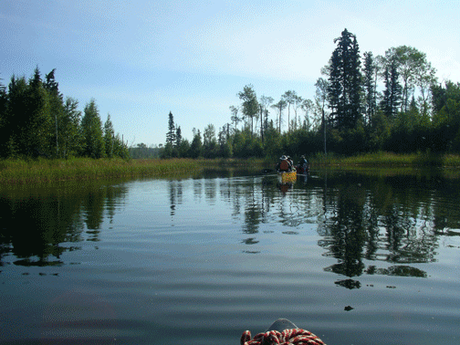
| We started today with an offering to Manitou for a safe trip as we began our journey on the Sturgeon-weir River. We held to our routine: on the water by eight, off about four and covered 22 miles. The feature of the day: mirror lakes. |
 |
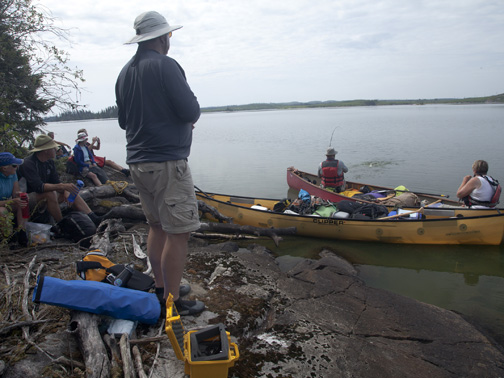 |
| It was multiple passes on the mechanical portage and a stop for lunch and some fishing, |
 |
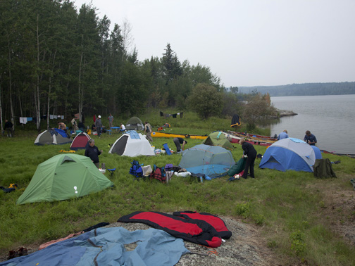 |
| It was beautiful water and an early arrival at our Grassy Narrows campsite with an opportunity for swimming and washing up. |
|