PAGE INDEX
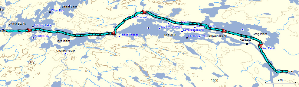
Route
Preparation
Schedule
References
The Crew
Rendevouz
DESTINATIONS
Missinipi
Stanley Mission
Potter Rapids
Grand Rapids
Frog Portage
Grassy Narrows
Pelican Narrows
Dog Rapids
Maligne Lake Settlement
Snake Rapids
Amisk Lake
North Channel
Denare Beach
Guest Book
Return to main |
THE PLANCanoe to Lower Grand Rapids (29 km)
Three portages: Total distance 202 m/ 220 yds
(assumes Grand Rapids Portage will be done on Aug. 8)
|
| MAPS |
Potter Falls to Lower Grand Rapids
Downloaded: Maps 3-A, 3-B, 3-C,
1:250,000 Series: 73P Lac la Ronge, 63M Pelican Narrows
1:50,000 Series: 73P/8 Nistowiak Lake, 63M/5 Trade Lake |
NOTES
from
Marchildon
&
Robinson
unless otherwise noted |
Healy Island
- North channel normal canoe path. Minor rapids at end; run river right.
- South channel can be run with "moderate" white water skills. Scout from shore first--fast run.
Keg Lake
- Keg Lake is David Thompson's Manito Lake on his map of the west.
- Inman Channel option--recommended route.
- Goes north before Island Rapids.
- Poling Place Rapids. 500 m (1/3 mi) from corner. Run down center at normal water levels. Can be dry.
- Rock paintings (73P 577403).
- Jump Rapids: Chute 10-12 m (30-40 yds) wide. High water: boisterous Class 3. Normal water: Strong Class 2 with straight tongue which can be run by advanced canoeists.
- Jump Portage: 100 m/110 yds long. River left about 50 m/55 yds upstream of rapids.
- Island Rapids option
- Used by voyageurs
- Too dangerous to run
- Portage is 120 m/130 yds. Starts in a little fjord on west side of westerly island.
Keg Falls
- 1-2 m (3-6 ft) extremely dangerous drop; must be portaged
- Best approach is along southwest shore of Grieg Island into a small cove east (river left) of the falls
- Keg Portage (80 m/88 yds). Break in trees at landing; need to be careful of current moving towards falls. Only difficult part is steep descent at downstream end.
- Few hundred meters below falls, rapids over 100 m (110 yds) long divided by island. Best course is extreme river left next to the island. Can be run by canoeists with modest whitewater skills.
Grand Rapids
- Upper Grand Rapid
- Uniform submerged ledge with 50 cm (20 in) drop across river; only a few narrow chutes
- Can be run if scouted from south shore, but much safer to portage
- Portage 2 m/yd. Pull-over a rock finger that joins the ledge on the south shore. Reach by hugging the south shore (river right) and paddling and/or wadding.
- Grand Rapids
- 600 m (1/3 mi) long Class 3 rapids.
- Required portage on river left.
- Grand Portage; 630 m/690 yds
- Located river left about 100 m (110 yds) upstream of rapids.
- Quiet water on in an east side cove. Landing is a rough outcrop of bedrock rising up to higher ground 3 m (10 ft) above the water.
- Portage in excellent condition with minor hazards where slippery poles bridge a tiny water run and where the trail descends steeply to put-in.
- Nice campground at start of Grand Rapids Portage
|
THE TRIP |
 |
We had a couple bigger lakes to cross today so were on the water by eight. Inman channel was fun paddling. After the Keg Portage, we entered the larger Keg Lake and the crew spread out some but still well in contact with each other. We did the Upper Grand Rapids and landed at the trail head intending to do the portage and camp at the end.
The portage was scouted and the report came back--NO WAY. There was a large blow down near the end with trees stacked over 6 ft. high. The decision was made to camp at the trail head and explore our options. Camp was made at 3:40 after covering 19.4 miles. |
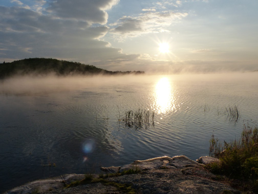
Sunrise on Drinking Lake |
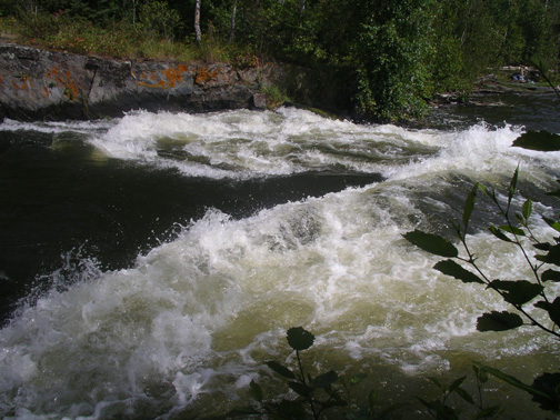
Jump Rapids |
Keg portage needed a little work to get to the easier part |
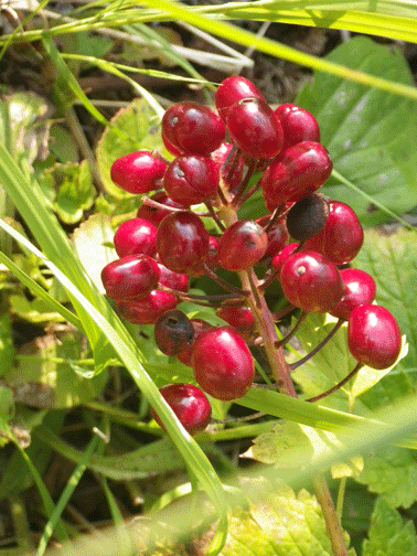
Stopped to smell the roses...well you know what I mean |
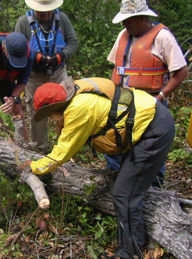
A good campsite is located at the head of the Grand Rapids portage...but not big enough for 11 tents. Some clearing of the nearby area was needed. |
|