PAGE INDEX
Route
Preparation
Schedule
References
The Crew
Rendevouz
DESTINATIONS
Missinipi
Stanley Mission
Potter Rapids
Grand Rapids
Frog Portage
Grassy Narrows
Pelican Narrows
Dog Rapids
Maligne Lake Settlement
Snake Rapids
Amisk Lake
North Channel
Denare Beach
Guest Book
Return to main |
THE PLAN
Paddle to Frog Portage (20 km)
One portage: 630 m / 690 yds
|
| MAPS |
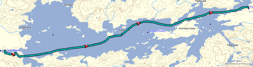
Lower Grand Rapids to Frog Portage
Downloaded: Maps 4-A, 4-B
1:250,000 Series: 63M Pelican Narrows
1:50,000 Series: 63M/5 Trade Lake, 63M/6 Manawan Lake |
NOTES
from
Marchildon
&
Robinson
unless otherwise noted |
Grand Rapids Portage:
- Located river left about 100 m (110 yds) upstream of rapids.
- Quiet water on in an east side cove. Landing is a rough outcrop of bedrock rising up to higher ground 3 m (10 ft) above the water.
- Portage in excellent condition with minor hazards where slippery poles bridge a tiny water run and where the trail descends steeply to put-in.
Trade Lake
- Big lake; can have dangerous winds in first 6 - 8 km (4 - 5 mi).
- Heavily used campsite located on extreme northeast end of Archibald Island
- Lake got its name from a very successful trading venture by Joseph Frobisher in 1774
Sigurd Olson Campsite. Camped at "the east end of a long rocky spit of an island about a mile from the portage into the Sturgeon Weir."
|
THE TRIP |
 |
| An interesting day...Grand Rapids portages...crossing Trade Lake with a wind from the north...arriving and camping at historic Frog Portage. On the water before eight...over two hours to portage Grand Rapids...arrived at camp a little after four...15 miles traveled. |
Grand Rapids |
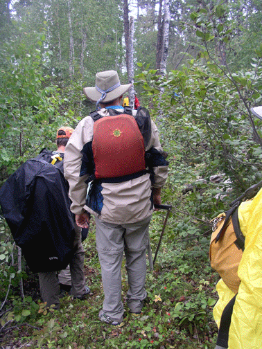
Merle and Al scouted the south side of Grand Rapids yesterday and found the remains of an old portage to a small pond that got us around the upper section. We assumed that there was a similar section on the other side of the pond. The upper section required some cutting to remove brush and we were able to pull/carry canoes and gear to the pond put-in.
A short paddle across the pond left us wondering "where now?" Bullrush covered the shoreline but a path through was found. Scouting revealed we could not cross the peninsula here, but could line to the north and then cut a relatively short trail to channel to Trade Lake. Some cut, others lined canoes and all pitched in to carry the gear and canoes across the freshly cut portage. Yes, this is wilderness canoeing in the north. |
| Trade Lake |
A short paddle brought us to Trade Lake and we got our first look at the 4.4 mi / 7.2 km crossing ahead of us. There was a north "breeze" strong enough to give us some moderate waves and swells, but not big white caps that would force us off the lake. The bad news was it was a cross wind. It was a good feeling when we got to the north shore of the arm leading to Frog Portage. |
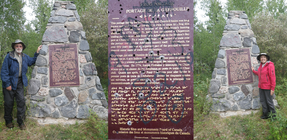
Inscription: This portage linking the Saskatchewan and Churchill basins was long known and used by native travelers; it owes its name to a frog skin once hung here by Cree in derision of the Chipewyan's hunting abilities. In 1774 Joseph Frobisher first intercepted a Chipewyan trading party here enroute from Lake Athabasca to the Hudson's Bay post at Churchill. Four years later Peter Pond carried the trade over this portage and into the Athabasca country itself. Thenceforth, for over fifty years this was an important part of the principal transcontinental canoe route of trade and exploration. |
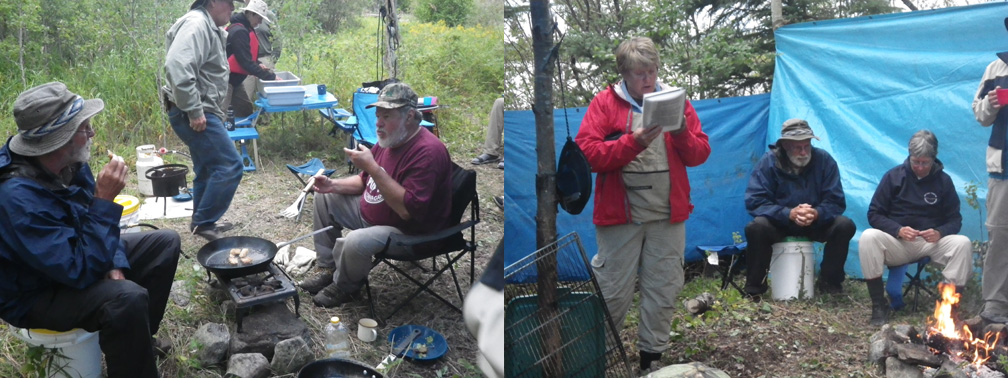
Roger's fish fry and Ellie's readings from 'Canoeing the Churchill' at Frog Portage Camp |
|