Peace River -- 112 km (70 miles)
Slave River (70 miles)
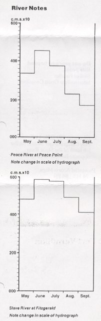
2. Rapids: Class I-III. 21 km (13 miles) stretch of Class VI rapids below Fitzgerald. Do not proceed beyound Fitzgerald.
3. Skill of Paddler: Intermediate Open Canadian
2. Kilometre 191 (Mile 119) Hay Camp Ranger Station on the left bank of the Slave River opposite Bocquene River
84 P Peace Point
84 L Fort Chipewyan
84 M Fitzgerald
84 P Peace Point
Provincial Access Maps
74M/L; 84 P/I
Chart 6321 Peace River-Lake Athabasca and Slave River to Jackfish River (scale 1:63,360)
Sixty-six km (30 miles) downstream from Peace Point, on the right bank, is Sweetgrass Landing. Sweetgrass Landing is a human-made clearing on the south bank of the Peace River. Watch for the sign and a steep cut that leads up the south side of the river -- it is easy to miss. At one time there was a small settlement here. Another of the Swanson Lumber Co. mill sites, it encompassed a landing strip, mill dock, church, store, school, dance hall and houses for workers and their families. As many as 15 million board feet of lumber were cut annually. When the mill closed down in the 1970's the company met park requirements for cleaning up the site. Buildings were bulldozed and burnt. Today as you make use of the picnic site, fire pit and outhouse, it is hard to imagine that such a lively community ever existed here. (The WBNP write-up discusses a side trip south of the Landing to the Sweetgrass Bison Management Station. The trip can include canoeing down Sweetgrass Creek and through Lake Claire and Mamawi to Ft. Chipewyan.)
Eighteen km (11 miles) downstream of Carlson Landing, the river makes a sharp bend around Rocky Point, recognized by a large rock outcrop right at water level on the north shore of the river. Across from Rocky Point there is fast water and eddies. On the right is the entrance to the Chenal des Quatre Fourches. A set of rapids is marked here but they are so small that they are not noticable. After you round the big meander at Rocky Point, past the rock outcrop, you will notice a group of three cabins on the north bank. Across from them is some fast water and eddies but they should not cause any problem. A certain amount of the Peace River's flow detours via this channel at high water or when the lower stretches are ice-jammed in spring. This water then flows across the Peace-Athabasca Delta to Lake Athabasca.
Seven km (4 miles) downstream of Chenal des Quatre Fourches on the north bank is the entrance to Scow Channel. By using this channel, the rapids at the confluence of the Peace River and the Slave River may be by-passed. There are very few camping spots along Scow Channel.
The Slave River drains north from Lake Athabasca, which is largely fed by the Athabasca River. The channel taking this water to the confluence with the Peace River is known as the Riviere des Rochers. The combined Peace River and the Riviere des Rochers then becomes the Slave River, which ultimately flows into the Mackenzie River.
The channels from Fort McMurray on the lower Athabasca to Fort Fitzgerald have been marked for barge navigation. When going downstream travel on the right side of red buoys and on the left side of black buoys. The opposite should be done if going upstream. The paddler attempting this tour must be expert in navigation by compass and hydrographic chart because the first section from Fort Chipewyan not only involves lake canoeing but also the determination of the correct channels across the bewildering maze of channels in the Peace-Athabasca delta.
After the completion of the Bennett Dam on the Peace River, significant changes took place in the delta area; some channels became very shallow and the natural aquatic habitat of the beaver, moose and waterfowl began to deteriorate. As a result, a number of weirs have been constructed both by government and local Indian bands to impound water and improve the wildlife habitat. One weir is on the Revillon Coupe. Another water control weir is at Little Rapids on the Riviere des Rochers. Orignally the rapids were caused by a rock outcrop across the stream and an old barge channel went around them behind an island on the right side. How this channel has be blocked and a control weir constructed across the bedrock of the rapids. A lifting device has been installed to portage large boats over the obstruction, but canoes must be lifted over manually.
Three Class III rapids are marked from the confluence of the Peace River/Riviere des Rochers and Fort Fitzgerald. The first marked rapid (on Access 74 M/L) is 6 km (4 miles) downriver of the Powder Creek confluence, in the channel to the right of a long island. The first major rapid is Primrose Rapids, at the narrowing in the main channel to the north of this island. These rapids could cause not trouble. The second marked rapid (on Access M/L) is Demicharge Rapids, 26 km (16 mies) downstream of Primrose Rapids, again at a constriction in the channel. Demicharge can either be run on the left of the island in the main channel or in the cdhannel on the right of the large island.
None of these rapids force you to go through them. You can avoid most of the standing waves by picking a route through and except for the rock islands that will only be submerged for a brief period of time at high water, there are no obstacles in the rapids. None of these rapids are marked on the N.T.S. 1:250,000 but are on the Hydrographic Chart 6301 (Slave-Athabasca). The third rapid is primarily an area of swifter current. Some maps may show mid-stream rocks.
From Hay Camp to Fitzgerald, the Wood Buffalo Park Road closely follows the left bank. On no account should the paddler proceed by river to Fort Smith which is 20 km (13 miles) to the north of Fitzgerald. This stretch has four very violent and dnangerous rapids; Cassette, Pelican, Mountain and Rapids of the Drowned. They are classified "not navigable" (Class VI+) and must be portaged.