SKYLINE TRAIL
47 miles
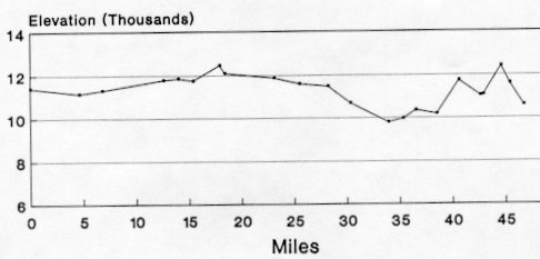
| Description | The Skyline Trail (#251) is the longest trail in the Pecos Wilderness circling the Pecos River drainage area. All but ten miles are above 11,000 ft. elevation. |
| Difficulty | Difficult |
| Comments | Much of the trail is above 11,000 ft. elevation. Hiking at these altitudes requires that hikers always be on the lookout for thunderstorms. Dehydration is also a common problem requiring attention to water intake. Water is available during the first half of the trail, but you must leave the trail to find it. You can find water north of Spring Mountain (there are no signs to the spring) and at the Rio Mora along Trail 239. Portions of Trail 251 are not shown on the USGS maps. Trail 251 from Trail 250 to Trail 456 and from Trail 254 to the end of the hike are not shown. These conditions make this a trail for experienced hikers only |
| To Earn Segment |
Hike trail as described. A four-mile side trip plus service work can be added to enable hikers to qualify for the 50-miler award. |
| Maps | USGS 7-1/2' Elk Mountain, Gascon, Pecos Falls, Truchas Peak, Cowles, Aspen Basin |
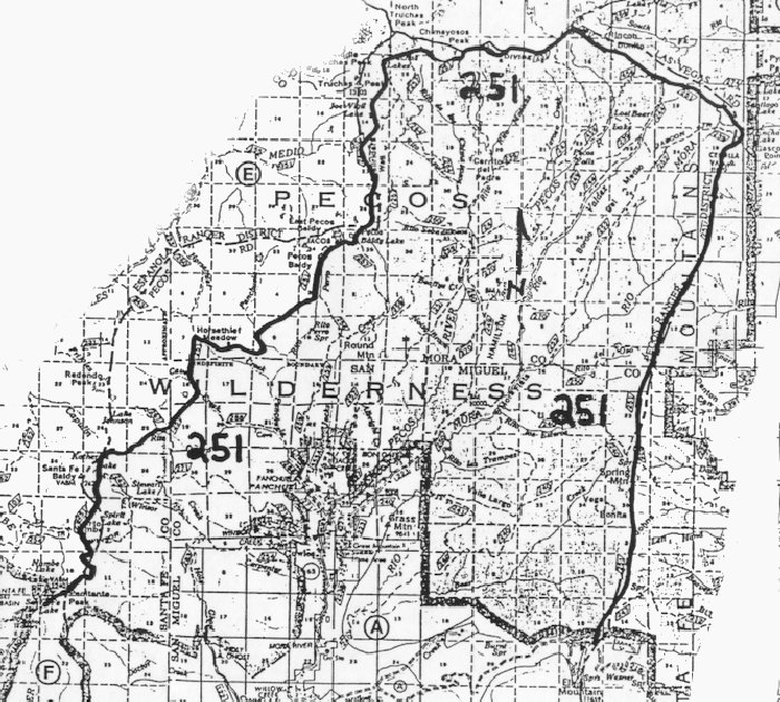
| Trail | Starting on Forest Service Road 645A near Elk Mountain: Trail 251 (46.7 mi.) -> Forest Service Road 150, Santa Fe Ski Basin. (See map) |
| Elevation Profile |
 |
| Transportation Requirements |
Parking is not available on Forest Service Road 645A. |
PECOS WILDERNESS TRAILS SERIES
EXIT TRAILS
Last updated: November 11, 1998