RIO MEDIO/RIO FRIJOLES
36 miles
| Description | The Rio Medio-Rio Frijoles route goes from Camp Frank Rand to the Rio Medio and back by the same route or to the Borrego Mesa Campground. Much of the trail follows streams with numerous crossings required. |
| Difficulty | Moderate |
| Comments | Trail 154 continually crosses the Rio Frijoles, so it is necessary to wade through the river a number of times. However, the water is usually less than knee-deep in summer and fall. Canvas or running shoes are recommended for this hike. Some trail junctions may be difficult to find. |
| To Earn Segment |
Hike trail as described. |
| Maps | USGS 7-1/2' Cundiyo, Sierra Mosca, Truchas Peak |
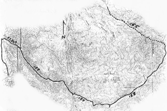
| Trail | Starting at Camp Frank Rand: Hike north from camp (2.4 mi.) -> Forest Road 307 west (1.5 mi.) -> Trail 154 (8.1 mi.) -> Trail 158 (5.8 mi.) -> Rio Medio; return by Trail 158 (5.8 mi.) -> Trail154 (8.1 mi.) -> Forest Road 307 (1.5 mi.) -> trail to camp (2.4 mi.) Camp Frank Rand. Optional return: From Rio Medio: Trail 155 (4.9 mi.) -> Borrego Mesa Campground. (See map) |
| Elevation Profile |
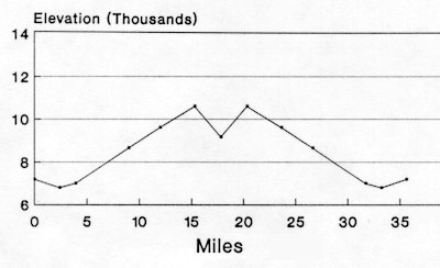 |
| Transportation Requirements |
Cars can be left at Camp Frank Rand. Make arrangements with Camp Ranger. For those planning on returning to Borrego Mesa Campground, you will need to pickup hikers at that spot; do not leave cars at Borrego Mesa campground unattended. |
PECOS WILDERNESS TRAILS SERIES
EXIT TRAILS
Last updated: November 11, 1998