INTERCAMP - TRUCHES LAKES
44 miles
| Description | The trail starts at Camp Frank Rand (Great Southwest Council) and ends at Camp Tres Ritos (South Planes Council). The trail traverses the Pecos Wilderness with a large portion above 11000 ft. |
| Difficulty | Moderate |
| Comments | Hiking along the Rio Frijoles/Trail 154 can be dangerous during times of high run-off; this is true for many areas in the first half of the hike. In the high country from before reaching Truchas Lake to close to the end of the hike, lightening is a problem. Cover should be sought with any sign of an approaching thunderstorm. Difficulty navigating can be encountered in the Trail 19/Forest Service Road 161 area because of the numerous trails and roads in the area. Altitude sickness is a potential problem; pay particular attention to drinking sufficient water. |
| To Earn Segment |
Hike trail as described. |
| Maps | USGS 7-1/2' Cundiyo, Holman, Jicarita, Pecos Fall, Sierra Mosca, Truchas Peak |
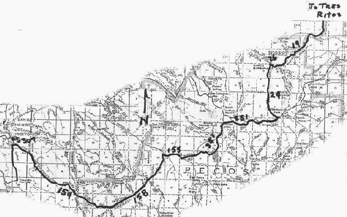
| Trail | From Camp Frank Rand: Hike north (2.4 mi.) -> Forest Service Road 307 (1.5) -> Trail 154 (8.1 mi.) -> Trail 158 (5.8 mi.) -> Trail 155 (1.5 mi.) -> Trail 351 (3.9) -> Trail 251 (7.1 mi.) -> Trail 24 (4.3 mi.) -> Trail 26 (0.5 mi.) -> Trail 19 (4.4 mi.) -> Trail 179 (3.8 mi.) -> Forest Service Road 89 (1.1 mi.) -> Camp Tres Ritos. (See map) |
| Elevation Profile |
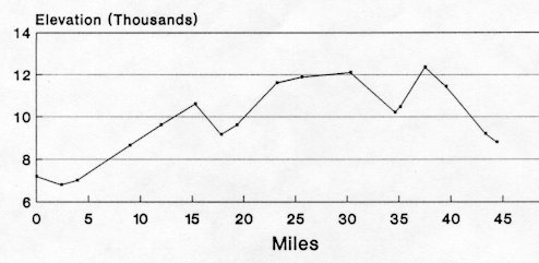 |
| Transportation Requirements |
Arrangements must be made to pickup hikers at Camp Tres Ritos after leaving hikers at Camp Frank Rand. |
PECOS WILDERNESS TRAILS SERIES
EXIT TRAILS
Last updated: November 11, 1998